
Other names: Alphana, All'Anfang
Population: 105000 (25000 of which are slaves)
Governance: Patriarch Amir Honak and Procurator Oderin du Metuant
Foundation date: 1589 before BF
Derographical affiliation: Meridiana: Peninsula of Al’Anfa
Political affiliation: Alanfan Empire
Trade Zone: ALA
Traffic routes: Palace Road, Road to Pinnacht, Pearl Sea

Population: 6500
Governance: King Wendelmir VI Zornbold, together with the city council of Andergast
Foundation date: 869 before BF
Derographical affiliation: Ingval Valley
Political affiliation: Barony of Andergast
Trade Zone: AND
Traffic routes: Prince’s Road, Bridge to the Sâlweg, Teshkalian Road, Ingval
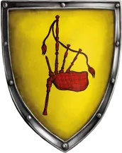
Population: 5300
Governance: Head of the Guild Council, Imperial bailiff Bosper zu Stippwitz
Foundation date: 752 before BF
Derographical affiliation: Kosch: Hilly Lands (between Lake Angbar and Kosch Mountains)
Political affiliation: Middenrealm: Principality of Kosch: County of the Hilly Lands
Trade Zone: GAR/ZWE
Traffic routes: Imperial Road 3, Greifenpass, Grevensteig

Other names: Ballûng-în-hoîh
Population: 3500 (800 of which in the county seat)
Governance: Ardariel Nordfalk von Moosgrund
Foundation date: 526 before BF
Derographical affiliation: Weiden
Political affiliation: Middenrealm: Duchy of Weiden: County of Baliho
Trade Zone: WEI
Traffic routes: Imperial Road 2, Pandlaril, Redwater

Other names: Bey-el-Unukh, Bey-el-Ulunkh, Beylunk
Population: 7500
Governance: Praiocracy: Princess Illuminata Gwiduhenna of Faldahon
Foundation date: 1572 before BF
Derographical affiliation: Tobria: Beilunkia: Coast of the Gulf of Perricum
Political affiliation: Middenrealm: Margraviate of Sonnenmark: March of Beilunk
Trade Zone: RHA/GP
Traffic routes: Gulf of Perricum, Radrom, Herzogs Street, Radrom Path, coastal road from the Arve Pass

Population: between 15000 and 20000
Governance: Primesta Pervalia ya Terdilion
Foundation date: 878 before BF
Derographical affiliation: Fairfield: Coverna
Political affiliation: Horasian Empire: Republic of Belhanka: Citymark of Belhanka
Trade Zone: HOR
Traffic routes: Silem-Horas Street, Sikramstieg, Sikram, Sea of the Seven Winds
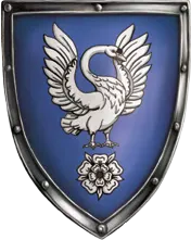
Population: 1050
Governance: Baroness Liwinja von Bjaldorn
Foundation date: 372 BF
Derographical affilication: Nivesland: Nornja, Nordwalser Hights
Political affiliation: free city of the North
Trade Zone: GLO
Traffic routes: Lettastieg
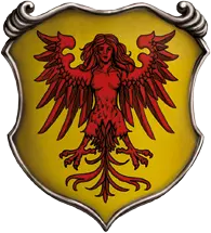
Other names: Brabacia
Population: 4000
Governance: Mizirion III. de Sylphur
Foundation date: 762 before BF
Derographical affiliation: Meridiana: Mysobia
Political affiliation: Kingdom of Brabak
Trade Zone: BRA
Traffic routes: Mysob Street, Coastal Street, Mysob, South Sea
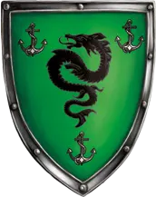
Population: 2000
Governance: Council of Captains
Foundation date: 499 BF
Derographical affilication: Meridiana: Altoum, Charyptic
Political affiliation: independent (as member of Black Alliance)
Trade Zone: ALA/CHA
Traffic routes: Charyptic, Strait of Sylla
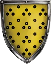
Other names: Khorop, Corapia
Population: 1500
Governance: de iure city councilor, de facto Adnan Zeforika
Foundation date: 992 before BF
Derographical affilication: Meridiana: Askania
Political affiliation: independent (as member of Black Alliance)
Trade Zone: MEN
Traffic routes: Magistrala Askania, Rabensteig, Way to Nasha, Askanian Sea

Other names: Jelenvinia
Population: 12500 (200 of which are dwarves)
Governance: Hagrobald Guntwin of the Great River, Steward Ardo
Foundation date: 316 before BF
Derographical affiliation: Northmarches: Elenvina Plain on the Great River
Political affiliation: Middlerealm: Northmarches
Trade Zone: ALB
Traffic routes: Great River, Imperial Road, Iron Road, Phecadistieg
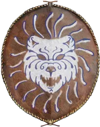
Population: 130 (90% Nivese, plus some Norbards)
Governance: free settlement
Foundation date: unknown, before 800 BF
Derographical affiliation: Nivese Lands
Political affiliation: independent
Trade Zone: NIV
Traffic routes: Caravan route to Kirma

Other names: Yol-Fassar
Population: 40000 (32000 tulamydes and novadi, 65000 middenrealmers, 1200 dwarves, 500 forestfolk)
Governance: Eminences
Foundation date: 2046 before BF
Derographical affiliation: Tulamyde Lands: Mhanadistan
Political affiliation: Kalifat: Sultanat Fasar
Trade Zone: MHA
Traffic routes: Crown roads to Palmyrabad and to Nasir Malkid, Cedar Road to Punin, Caravan route to the Khôm

Other names: Bornemund
Population: 35000 (3500 of which are goblins)
Governance: Grand Council
Foundation date: 189 BF
Derographical affiliation: Bornland: Mainland
Political affiliation: free town
Trade Zone: BOR
Traffic routes: Born Road, Imperial Road, Coastal road to Neersand, Born, and Pearl Sea

Population: 170000 (1000 dwarves, 500 elves, some goblins, grolms and deep dwarves)
Governance: Empress Rohaja of Gareth, Councilor Thorn Eisinger
Foundation date: 876 before BF
Derographical affiliation: Middenrealm
Political affiliation: Middenrealm: Kingdom of Garetia
Trade Zone: GAR
Traffic routes: Imperial roads 2 and 3, Gardel
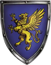
Population: 5000
Governance: Margravine Irmenella of Wertlingen
Foundation date: 679 before BF
Derographical affiliation: Middenrealm, Margravate of Griffonsford
Political affiliation: Middenrealm, Margravate of Griffonsford
Trade Zone: GAR
Traffic routes: Prince Road, Mark Path, Imperial Road 1


